Geo Strategies maintains the most detailed topographic, hydrographic and road maps for Romania as well as administrative boundaries and linked databases of commercial information.
Vital content for business applications
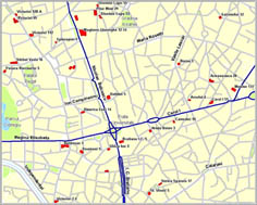
Geo Strategies divides its mapping for Romania into two categories: Standard Mapping and Value Added Mapping.
The latest release of standard mapping includes –
Integrated national road and street network
- Highways
- Major and minor roads
- Street plans for over 13,000 localities
Railways
Waterways and lakes
Administrative boundaries
- National
- Regions
- Counties + Bucharest (42)
- Communes (3,180)
Localities & Settlements
- Towns & cities (325)
- Communes (2860)
- Villages (10,569)
The projection is Lat/Long WGS-84 and the data can be delivered in virtually any format.